

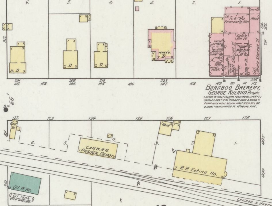
Sanborn Maps
Detailed maps of Sauk County communities showing buildings, what they were constructed from and their immediate surroundings were produced by the Sanborn Company beginning in the 1880s and continuing well into the 20th Century. The maps were produced to help fire insurance companies assess the relative risk of a building without seeing it in person.
Today the Sanborn maps provide snapshots in time of the buildings in a community and how they changed over time. They can be used to date buildings and additions and also give context to historic photographs. While the early maps only covered commercial and industrial buildings, later maps covered residential buildings as well. Maps exist for Ableman (Rock Springs), Baraboo, Reedsburg, Prairie du Sac, Sauk City, and Spring Green. Many of these maps are now available online.


1904 Baraboo, Train Depot
1898 Baraboo, Train Depot