
The Old State or Military Road
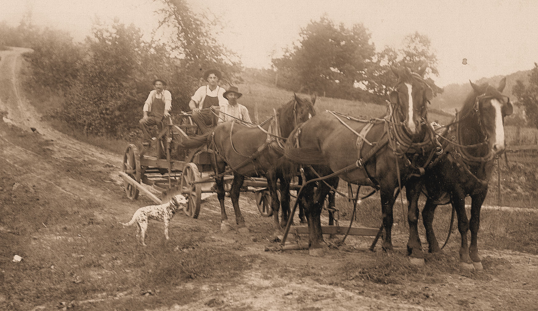
May have looked similar to this road
By William Toole, Sr.
Published, Feb. 15, 1923
Our family moved from Section 8 in the town of Excelsior, Sauk County, to the S.E. ¼ of Sec. 26 in the same town during the winter of 1863-64. We had not long been acquainted in the neighborhood when my curiosity was awakened by hearing the neighbors on the bluffs north-west of us, speak of the “Old State Road,” which then crossed the bluffs in a northwesterly direction from the valley which is northwest from where now is the village of North Freedom. This road was closed by farm clearing, shifting the route to surveyed lines, but traces of the old road are yet to be seen in the brush pastures.
No one could tell me why it was called the “Old State Road.” Later I heard people in the Hackett’s Corner neighborhood where now is North Freedom speak of the “Old State Road” where it crosses the bluff to the south. It was many years before I could get any explanation why the name “Old State Road” was used. The late Mr. Ed Trumble of North Freedom said the name should be “The Old Military Road,” and that the road was made by troops who pursued Black Hawk and his followers, after the battle of Wisconsin Heights in July, 1832. Mr. Trumble claimed a special interest in the route, because his father was a soldier in that war, having taken part in the fight of Wisconsin Heights with reinforcements from Fort Winnebago. Mr. Trumble claimed to have traced the route westward to Crawford County, but had not been able to locate it south of the town of North Freedom.
In 1921 I heard Mr. William Rich of the town of Sumpter tell of the closing of a piece of the “Old State Road” on the farm of A. Kindschi on Section 1 in the North-East part of town of Honey Creek. Knowing that the late Frank Abbott was an old settler in that neighborhood I interviewed him in the summer of 1922 and learned that he had taken special interest in the “Old State Road” because some years ago there had been a move to open up and improve this old road, making a more direct route between Prairie du Sac and Reedsburg. It seems the people of the town of Honey Creek objected to the expense they would incur so the project was given up. Mr. Abbott had learned from his father that the old road met the road which passes through the Stone’s Pocket Valley near the house on the farm formerly owned by Mr. George Astle on section 7, town 10, range 6. Mr. Abbot said that the course of the old road may yet be plainly seen where it ascended the point of the bluff. Its course was through the north-east corner of the town of Honey Creek into the town of Freedom and meeting the present road near where Mr. Jake Zimmerly formerly lived. He did not know what was the continuation of the “Old State Road” southward or eastward but he remembered that when he was a boy the road through Stone’s Pocket Valley was not on surveyed lines but was south of its present course and nearer the bluff. I have since learned from Mrs. Stephen Premo of the town of Sumpter and from Joe Johnson now of the city of Baraboo that the road extending westward from Payne’s Corners was a part of the “Old State Road”. Mr. Sam McCoy of North Freedom has told me that the course of the “Old Military Road” descended the bluffs past the old McCoy homestead.
I have not had an opportunity to interview any old settlers west of the town of Excelsior but have written out the supposed course from notes taken from Mr. Trumble. One familiar with the lay of the country can really imagine the probable line of retreat from Wisconsin Heights’ to Payne’s Corners.
The course of the route which I have been able to identify is extending westward from near the center of section 10, town 10, range 6 in the town of Sumpter, though section 9 and 8 to nearly the west side of section 7; from there northwestward through section 1, town 10, range 5 in the town of Honey Creek, across the southwest corner of section 36, near the east side of section 35, town 11, range 5, in the town of Freedom, passing into what is now known there as the “Old State Road.” As before mentioned, according to Mr. S. McCoy, the route diverged from the present main road, passing down the slope through the old McCoy and Hanger farms and on through where the village of North Freedom now is. The course was northward along where the present line of road is to the south line of Excelsior, and from there northwesterly through section 35, the southwest quarter of section 26, and the northeast quarter of section 27, town 12, range 5, descending the north slope of the bluff in the direction of the Baraboo River and crossing the Baraboo River where the old road enters what has been known as the Buckeye settlement. From notes taken while talking with Mr. Trumble I have his description of the line of retreat and pursuit. “The Military Road crossed the Baraboo River at the old Hubbard Bridge and continued westward through the Buckeye settlement, passing by the south side of the place known as the Buckeye Stock Farm and continued westward along the ridge, passing about two miles north of the County Poor Farm. The road continued on towards the south of Lime Ridge through the Wheelerburg country. In all of this course they avoided the valleys, following the ridges. From Wheelerburg they passed through Sandusky and followed the ridge westward until reaching Bear Valley, which they crossed, and then again took the high ground to the north of Ithaca. They then passed by the north of Richland Center, crossing Ash Ridge west and north of Twin Bluffs and continued west to near what is called Eagles’ Corners. Then passing north of Port Andrews and south of Excelsior they reached the Mississippi River about ten miles north of the Wisconsin River. A gunboat happened to be on the Mississippi River and helped in the capture of the Indians by preventing their crossing the river.”
Those who have read the published history of the Black Hawk War will notice that Mr. Trumble was not correct in his description of the latter part of the course of the retreat and pursuit for we have learned that the final conflict was in Vernon County near where the Bad Axe River empties into the Mississippi.
The question may be asked, “Why did the Indians take such a seemingly out of the way route?” when they could have reached the Mississippi River much more directly by keeping more nearly to the Wisconsin River Valley. It will be noticed that the same question occurred to those who pursued the Indians as it indicated in the historical extract which I shall here quote. On page 150, Vol. X, of the Historical collections of the Wisconsin State Historical Society, is the beginning of an account of the Black Hawk War by Captain Henry Smith of Atkinson’s Brigade. His party evidently came up too late to take part in the Battle of Wisconsin Heights, which was fought on the afternoon of July 21st, 1832. After the battle the Indians crossed the river at an island below where Sauk City now is. Black Hawk in his autobiography says that a few of his people went down the Wisconsin River, but he and most of his followers had no means of going down the river and after crossing went over some very rough country before they reached the Mississippi River. The white troops did not follow the Indians across the Wisconsin River, but after the battle returned to Blue Mounds and many of them to their homes. Troops were again assembled and crossed the river on July 27th at a place called Helena, about opposite where Arena now is.
Captain Smith in his narrative says: “Before the arrival of the army at the Wisconsin River it was met by an express with information that Henry and Dodge had come up with the Indians near the river and defeated them. Rafts were constructed and the army crossed at a small village called Helena and within two hours struck the trail of the enemy. Their trail gave evidence that their number must be considerable. Their order of march was in three parallel columns. Over the dry prairie the route of each column was worn two to six inches in the earth. Where the ground was marshy their trail appeared like ordinary traveled roads, wanting only the tracks of the wheels. From this time until we reached the Mississippi River we continued without deviation to follow the trail of the enemy, having no other guide and led, doubtless with a view of baffling the army, over a country I venture to say such as has seldom been marched over, at one moment ascending hills almost perpendicular through the thickest of forests, then plunging through morasses, fording to our necks, creeks and rivers and passing defiles where one hundred resolute men could have defeated ten thousand, next climbing mountains perfectly bald without so much as a bush to sustain a man. The Indians were under the impression that it was impossible for us to follow them, and to that error we probably owe our ultimate good fortune in overtaking them or at least bringing them into action on grounds of equality. We each day made two of their days’ marches, passing one or two of their camps. We frequently passed their dead, who exhausted by wounds or fatigue had expired and fallen from their horses. On the first of August we passed the bodies of eleven and a little before sunset learned from a prisoner that the enemy was but a few miles in advance of us. Up to this time not a man of the army knew where we were save that we were north of the Wisconsin River and that we were on the enemy’s track. On the second of August the Indians were found planning to cross the Mississippi on rafts.”
It is stated in the Historical Collections that a copy of Captain Smith’s report was published in the Rockford Journal, Aug. 12th, 1882. The editor of the Journal appended to this publication of Captain Smith’s narrative, an outline of the route pursued by Atkinson’s troops. Passing by the account of the course through Illinois we note the Wisconsin line was crossed about one mile east of Beloit. The east bank of Rock River was followed until they came to Lake Koshkonong, where the river was crossed and the army took a westerly course, passing through Dane and Iowa Counties to the Wisconsin River at Helena where they crossed the river. From this point the direction was a north and west course, passing through Sauk and Richland Counties, the north-east corner of Crawford county some twenty or twenty five miles from Prairie du Chien, and through Vernon county to where the Indians were overtaken at Bad Axe River, where the final battle was fought.
This march was through an entirely new country; no white man had ever passed through it before.
Mr. Trumble held the opinion that there was a division of the white forces and that they met together before the final battle but judging from what we have read in Captain Smith’s account such division does not seem possible.
I wish to call attention to several interesting points in Captain Smith’s narrative, having a special bearing on the thought that the “Old State Road” is the route which was traveled in pursuit of Black Hawk and his followers. In speaking of the route followed in taking up the trail after crossing the Wisconsin River he first speaks of crossing the dry prairie and over marshy ground which corresponds to the route from the Wisconsin River to and through the valley west of King’s Corners. Crossing the 2 ranges of bluffs on each side of the Baraboo River would include the rocky defiles where the troops might have ambushed if they had followed the Indians immediately after the Battle at Wisconsin Heights. One morass they crossed was on the bluffs in the town of Excelsior, northwest from North Freedom. Captain Smith talks of crossing creeks and rivers. They crossed the Baraboo River at two different points on opposite sides of the range of bluffs which must have caused them to think that there were two separate rivers. If they had taken the more southerly course and later turned northward they would not have included rivers in their route.
After reading Captain Smith’s description of the pursuit of the Indians after crossing the Wisconsin River, I am convinced that what we know as the “Old State Road” or Military Road is a part of the route which was taken when following the Indians to the Mississippi.